(click any picture to get enlargement)
This story requires a short
introduction: Venezuela is located on the top of South America, between
Colombia & Guyana. 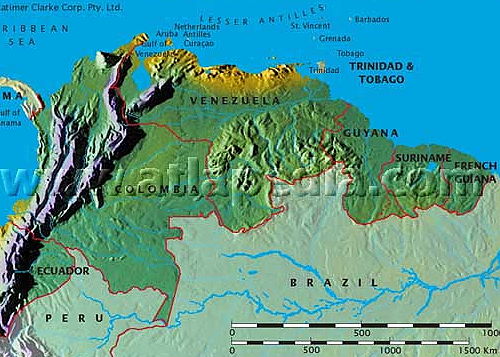
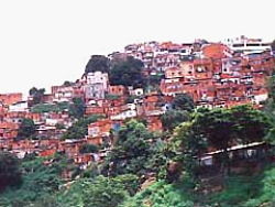
Caracas, the capital, sits along the coast and is the largest city.
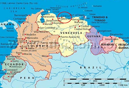
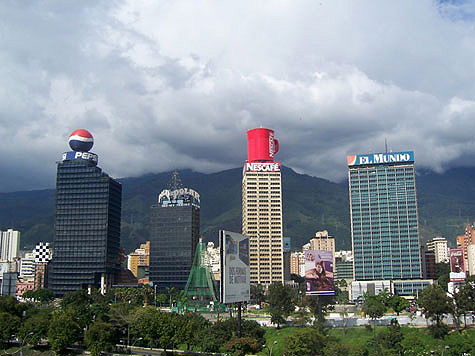
Caracas has over 4 million inhabitants & lots of high-rises.
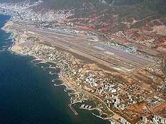
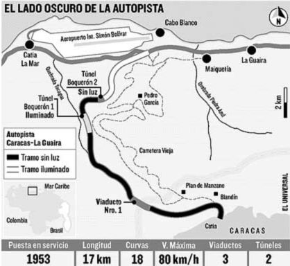
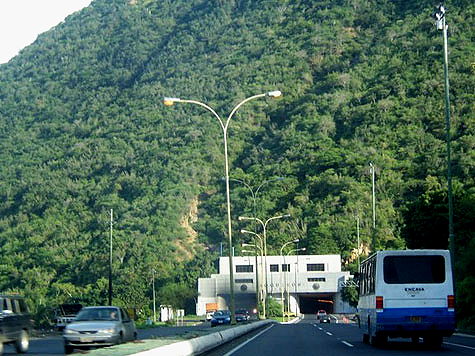
The airport is quite nice and is located on the coast.
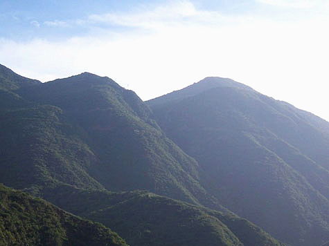
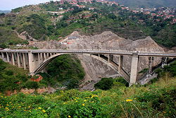
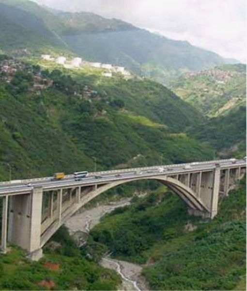
The Avila mountains separate the city from the coast.
The Avila mountains are quite high & steep; thus it's not a easy task to get from Caracas to the airport or beaches.
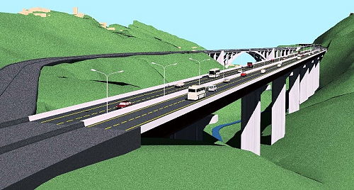
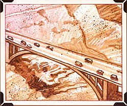
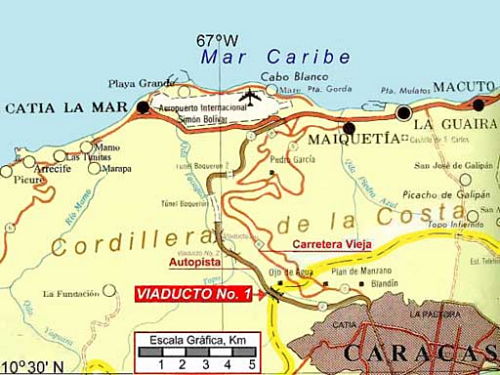
The drawing on the right (from the 1950's) shows the artist's depiction of the route they chose for a new highway.
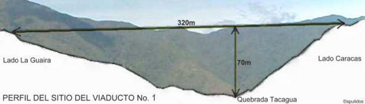
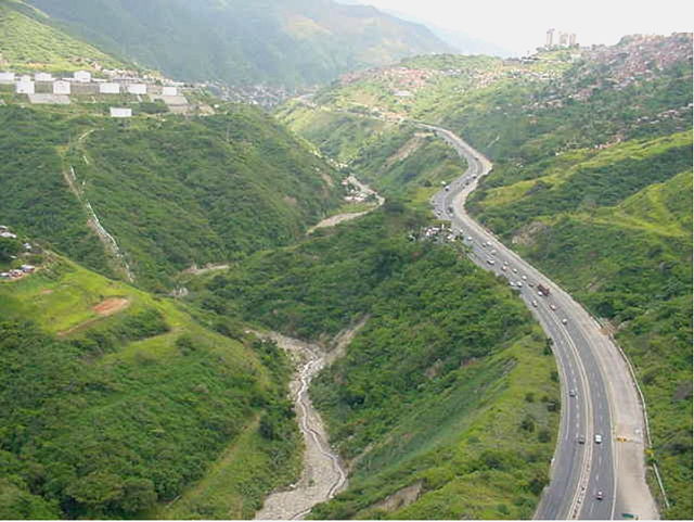
From Caracas the road would go along the steep side of a large valley, cross that valley, go thru a series of tunnels, and finally end up at the coast.
The distance wasn't far... only 17km (10 miles) but the obstacles made for a difficult task, especially back in the 50s.
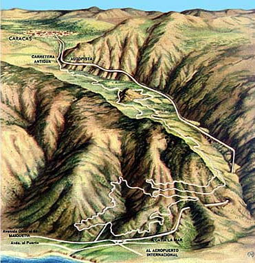
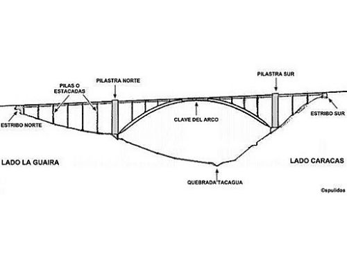
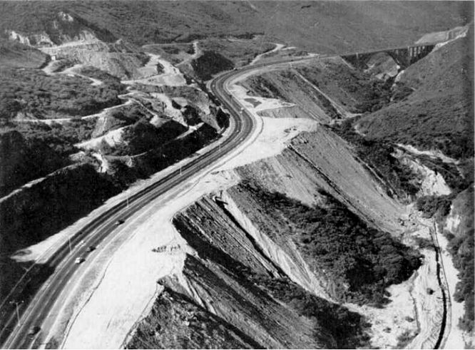
The diagram on the right shows a little more detail of the plan, which included a large viaduct (bridge) and a couple of tunnels. The doted line shows the old road which linked Caracas to the coast. It was hilly, windy, slow and hard to maintain.
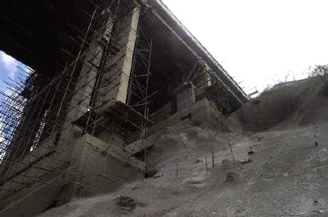
The roadwork began
...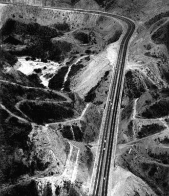
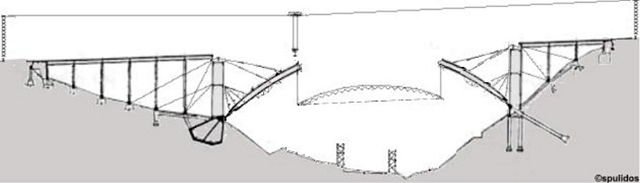
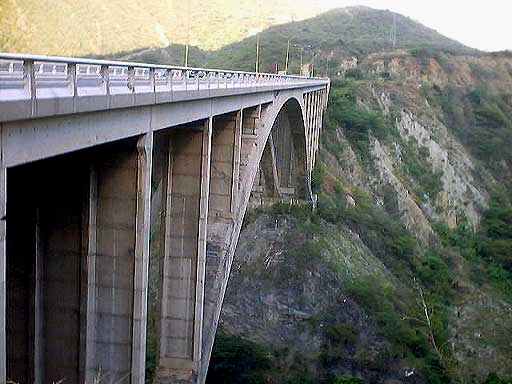
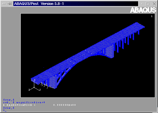
Then the viaduct plans were finalized. At that point in time it was one of the biggest engineering challenges in the world.
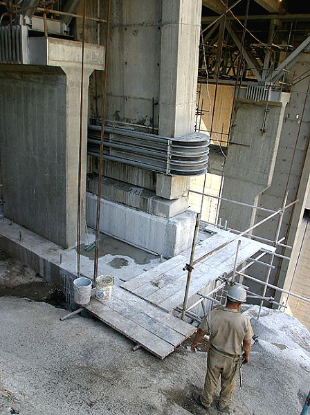
From the architectural plans,
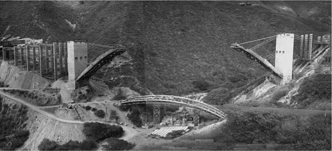
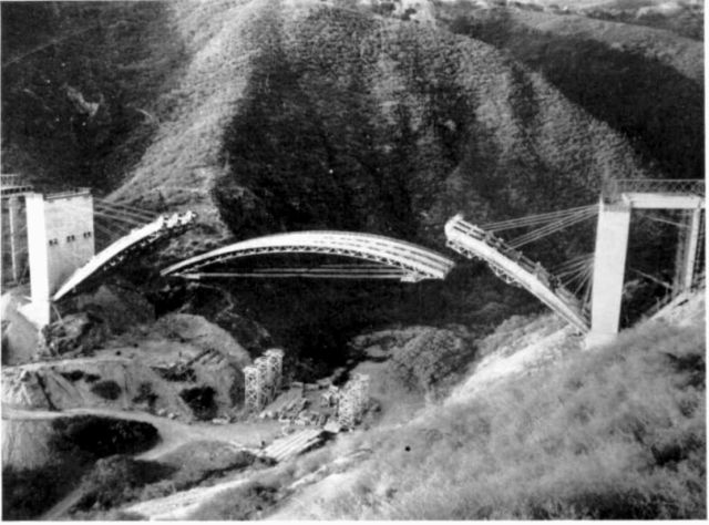
the construction began...
... it was quite a big project,
even by
today's standards!
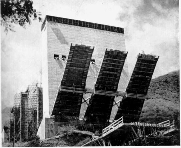
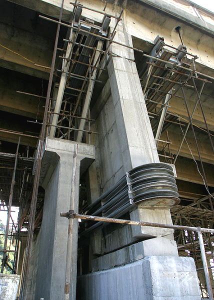
The final load-bearing structure is lifted into place.
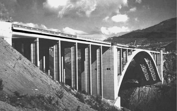
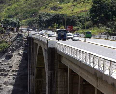
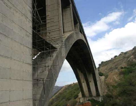
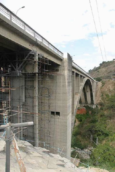
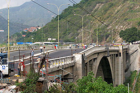
After years of work, the result was an
impressive highway...
only 30 minutes to the coast!
Fast-forward to today...
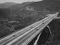
The highway system has had an ever-increasing amount of traffic using it, especially heavy trucks.
The highway have also been poorly maintained and have fallen into disrepair.
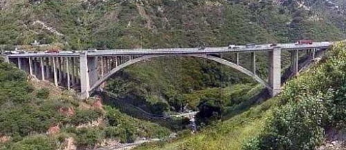
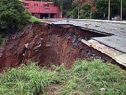
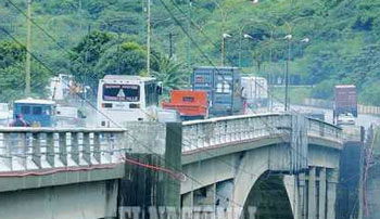
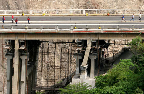
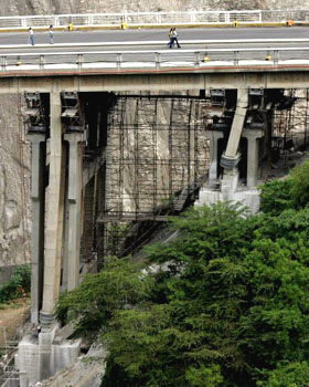
The viaduct began to show it's age, with a 'bulge' in the middle.
The engineers studied the problem and analyzed the geographical changes...

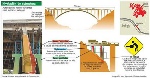
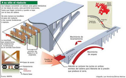
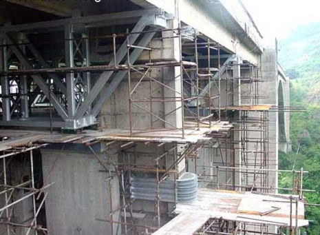
... and they came up with a plan to give the viaduct a facelift... by lifting one end and replacing the supporting structures... all to be done while the road was in use!
The ground around the area was coated to keep it from sliding.
Work was proceeding according to plan... but someone forgot to inform Mother
Nature.
We had a torrential rainfall and, as you can see by the 'slippage' chart to the right, bad things happened to the ground.
The chart shows the 'normal slippage' (in cm per year), which is pretty bad over the long term... but after this storm the whole hillside slide about 15 cm or more, which is over a foot!


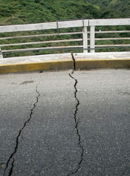
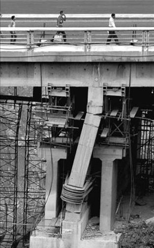
After the storm, cracks appeared in the roadway. It was obvious that sections of the viaduct had moved quite a bit!
The 'bulge' was even more prominent... and then the worst news arose ... the engineers found their repair work in ruins.
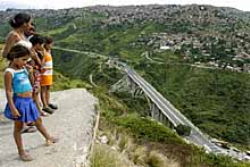
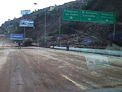
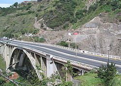
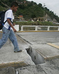
There was fear of collapse so the viaduct was closed to vehicles.
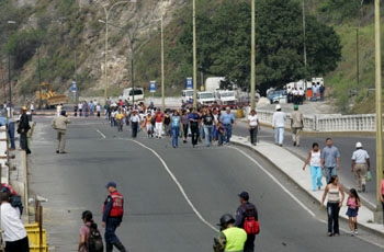
Since the viaduct was such an essential link,
many people crossed by foot ... hoping to catch a bus on the other side... but
soon it was totally closed.
At first there were many jokes circulated about
the situation; the picture on the right is a good example... most were aiming to
put the blame on the current government.
The government gave indications that all was under control... but soon it was apparent that getting to the coast would be a PAINFUL experience... that would have to be dealt with for a long time.


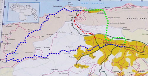
GREEN: Old cobblestone road over the Avila Mtns... 7000 feet! 4-wheel drive required, but quite scenic; estimate 1-2 stressful hours, but daytime only.
BLUE: Lengthy night route bypassing steep mountains; estimated time 3-5 tiring hours & no safe places to stop for a rest.
Now you know why you haven't seen many
people from Caracas and we have seen few visitors.
With all the hassles (2-5 hour trip) and costs ($150-$300) it just isn't
practical to travel.
Animation of the expected collapse of the viaduct.
It is rumored that casinos in Las Vegas are taking bets on when it will fall.
On the other hand, this is what the new
viaduct is supposed to look like...
... they must not think the old viaduct will fall, as it is still in the
background!